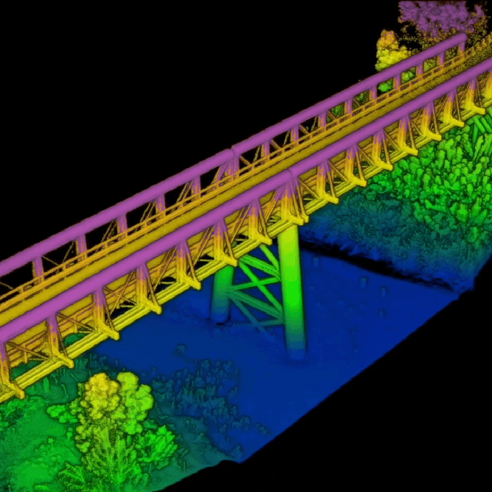
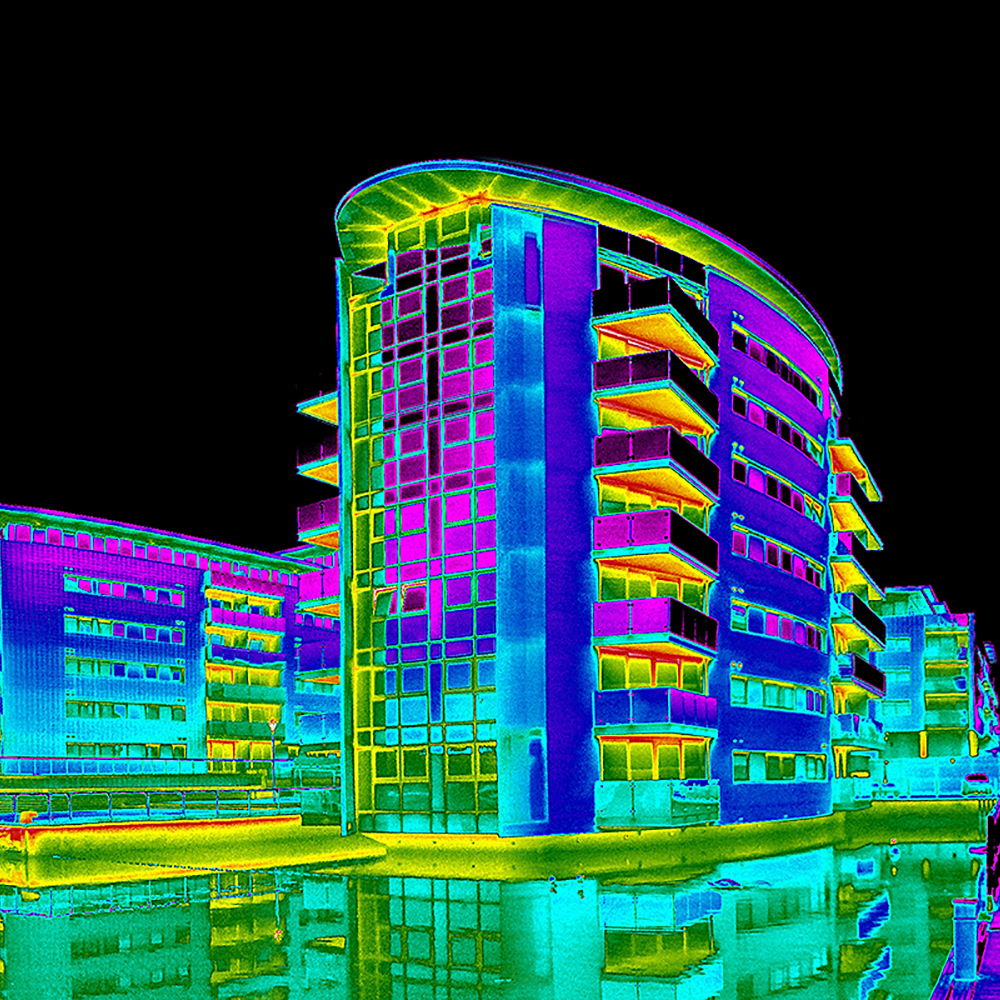
LiDAR laser surveying
Measure Australia will capture LiDAR point clouds, process and categorise them with fast turn-around. Drone LiDAR capture as a service, nationwide.


Fast & economical
MA delivers an optimised and efficient end-to-end service, from initial contact to data delivery and support.
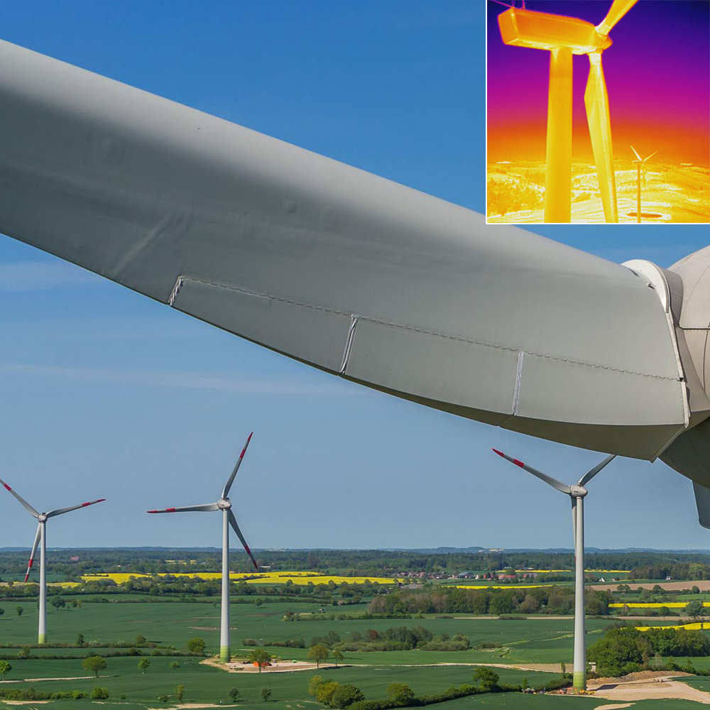
Best LiDAR technology
MA has the most advanced LiDAR sensors in Australia, including the only Reigl MiniVUX2. We deliver better accuracy and resolution point clouds than anyone else.
Nationwide service
MA has Australia's largest pilot network coverage, to efficiently service your projects even while lockdowns prevent some travel.
I can certainly say that our expectations were exceeded! Big picture, we easily and cost-effectively gained significantly richer LiDAR data than any we’ve worked with before.
The survey by Measure Australia saved time, money & resources compared with the conventional approach. It contributed to the project significantly without the cost of quality work.

Measure Australia delivers work for Sedgwick under catastrophe insurance events, often for extended periods and in extremely difficult conditions. Measure Australia is quick to respond, rapidly deploy and delivers data to our business that we cannot gain elsewhere in the time we need it.

MA is deeply experienced in drone and data services and this depth of experience makes them a reliable partner. Not all drone data is equal – MA delivers top quality data that forms the basis of analysis and insight to promote asset longevity.
