LiDAR Laser Survey.
Safe.
Accurate.
Fast.
There's a smarter way to survey...
From this...
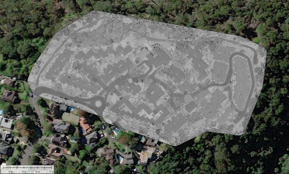
LiDAR point cloud colour black and white
...to this!
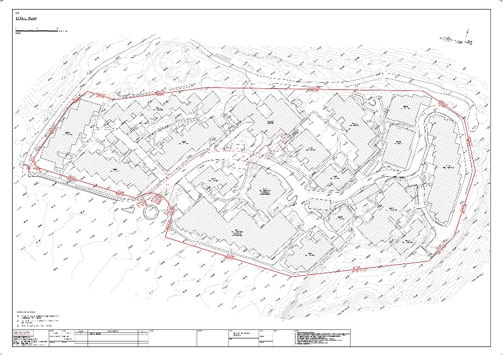
Detail plan of subject site
Other outputs for the same site

Cross section of LiDAR point cloud and ground layer
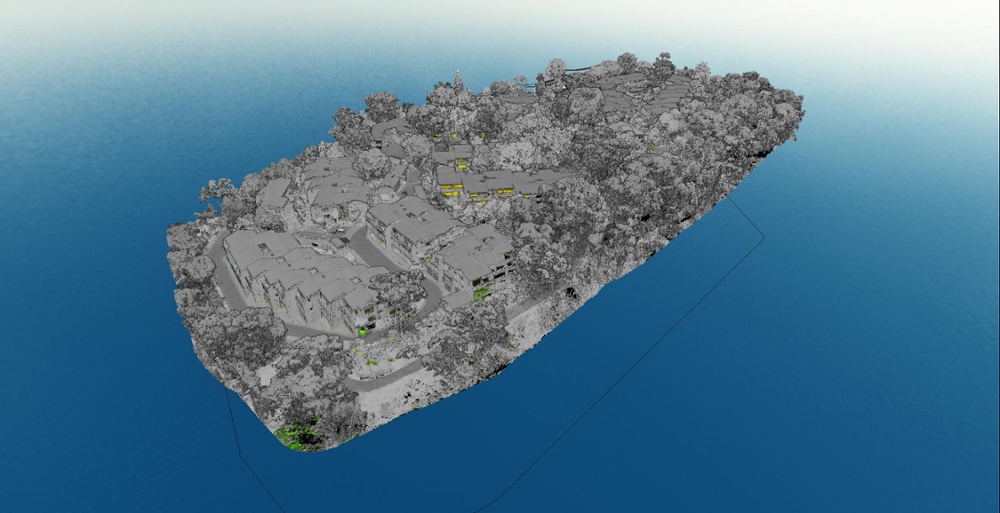
Terrain model with LiDAR points overlaid
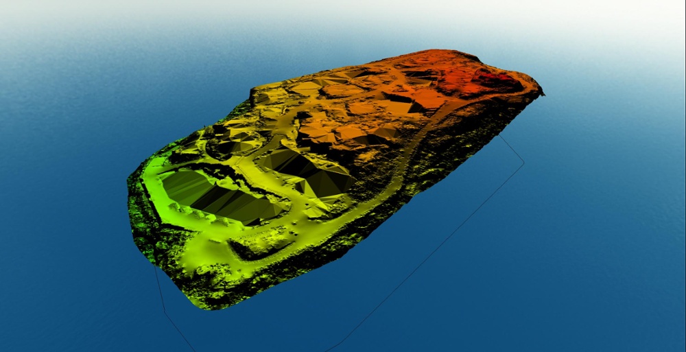
Terrain model with LiDAR removed
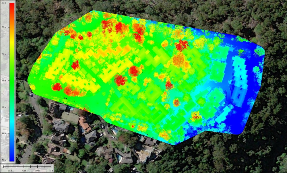
LiDAR coloured by elevation
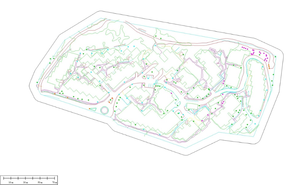
Vectorisation of LiDAR features
Why choose Measure Australia?

Accurate
Accurate & high resolution datasets displaying hundreds of millions of points to an RMSE of ~35mm.
Fast
Cover up to 3500ha per day on ideal sites, rapidly modelling terrain no matter the conditions.
Proven performance for leading companies.


Cross section through 0.5m thick slice of point cloud.
LiDAR laser surveying reduces the risks associated with traditional surveying.

Project Timeline
Projects are often delayed as an appropriate hazard assessment process needs to be carried out before starting work.

Traffic Control
Following safety guidelines is recommended, such as placing warning signs or orange cones in your work area and wearing a high visibility vest, but drivers are often distracted. Sometimes despite these precautions, accidents occur.

Building Hazards
Every building site is different, due to which various safety procedures are required. Building Hazards increases the cost of surveying and potentially delay the timing sometimes.

Weather Forecast
Mother nature isn't concerned with survey project timelines. Traditional methods of surveying need more time for arrangements compared to LiDAR Surveying.
Classified point cloud of an industrial park in Sydney NSW.
Our clients attest to the quality of our work.
Shellharbour City Council
On-Time. Under Budget. Accurate.
Shellharbour City Council engaged Measure Australia (MA) to conduct LiDAR laser surveying at six locations within the local government area. Sites ranged from 5ha to 600ha with MA delivering all sites to an extraordinary level of detail. As part of the works, MA mapped areas within the boundary fence of Shellharbour Airport, working with Council and CASA to ensure safe operations for all involved. MA's field and data teams are highly experienced, and Shellharbour City Council would recommend MA to customers who have complex data collection needs, with demanding output requirements. MA delivered on-time and under budget, and exceeded our expectations every step of the way.
- Adam De Clouett, Acting Group Manager
Orion Spatial
Quality. Speed. Resolution.
Orion Spatial Solutions utilise Measure Australia (MA) on various complex spatial jobs. MA has the latest in survey grade drone-based LiDAR and Orion have an extensive background in geospatial projects. When coupled with MA's skills and equipment in the field, this enables us to deliver high-quality data on a repeatable basis. MA regularly undertakes some of the largest drone-based LiDAR projects in Australia. Projects over 5000ha+ in size in the mining and petroleum environments are becoming standard for the team. Orion would recommend MA to any user that requires high-resolution drone-based data capture, at large scale, in demanding environments.
- John Philipp, Director
Squadron Resources
Skilled. Terrain Mapping. No Delay.
Squadron Resources engaged Measure Australia (MA) to undertake terrain mapping of 3000ha of mining tenement near Carnarvon WA. MA's team delivered the data in difficult circumstances during the coronavirus lockdown without delay. The quality of data was exceptional with high accuracy across the entire site. MA delivered an additional quality report that facilitated reporting to the WA Department of Mines and Petroleum. The MA team is highly skilled at LiDAR laser scanning as well as complex remote deployment, enabling Squadron Resources to focus on core business.
- Scott Bilben, Principal Geologist


